Rare Early Map of the Republic of Texas
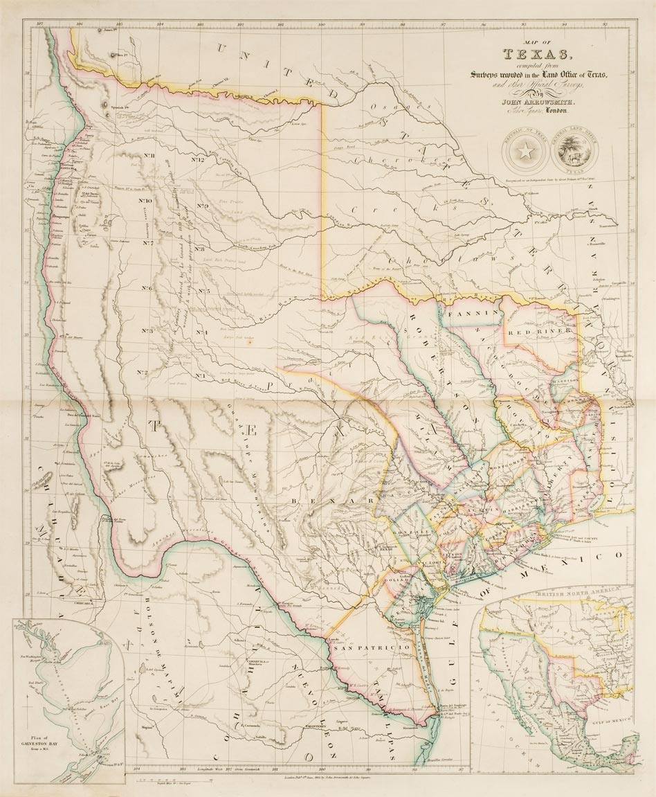
John Arrowsmith. 'Arrowsmith'sColonial Atlas', exhibiting the physical & political divisions of the various countries of the world, constructed from original materials circa 1845, lacking title and endpapers, contents list in manuscript and tipped in, forty-four engraved and lithographic maps, mostly double page, including nineteen on Australia and New Zealand and sixteen on North America, Canada and the West Indies, including the important double page map of Texas (2nd state dated 8th June 1843), additional manuscript list of titles tipped in at rear, near contemporary half morocco gilt, worn and rubbed, folio
This incomplete atlas retains the very rare map of the newly recognised Republic of Texas. Arrowsmith's map of Texas was probably the first to show the full extent of Texas's claim to the region of the upper Rio Grande, an area included within Texas's boundaries until the Compromise of 1850.
Estimate £7000-10,000
Upcoming Auctions

Old Master Prints & Drawings, British & European Paintings, Drawings & Prints
To see a page-turning version of our catalogue, please see the Virtual Catalogue.
Live bidding is available on our website on sale day, a BID LIVE button will appear 60 minutes before the sale starts. Please register at least 24 hours before the sale starts. Commission bids can be left on our website up to 1 hour before the sale commences. For telephone bids, please call the office on 01285 860006.
Old Master Prints, Drawings & Paintings 1-99
19th Century Paintings, Watercolours & Prints 100-166
Japanese Prints & Indian Art 167-188
European Sculpture 189-192
20th Century Paintings & Watercolours 193-247
George Mackley Woodblocks from the Patricia Jaffé Collection 248-263
20th Century Prints 264-290